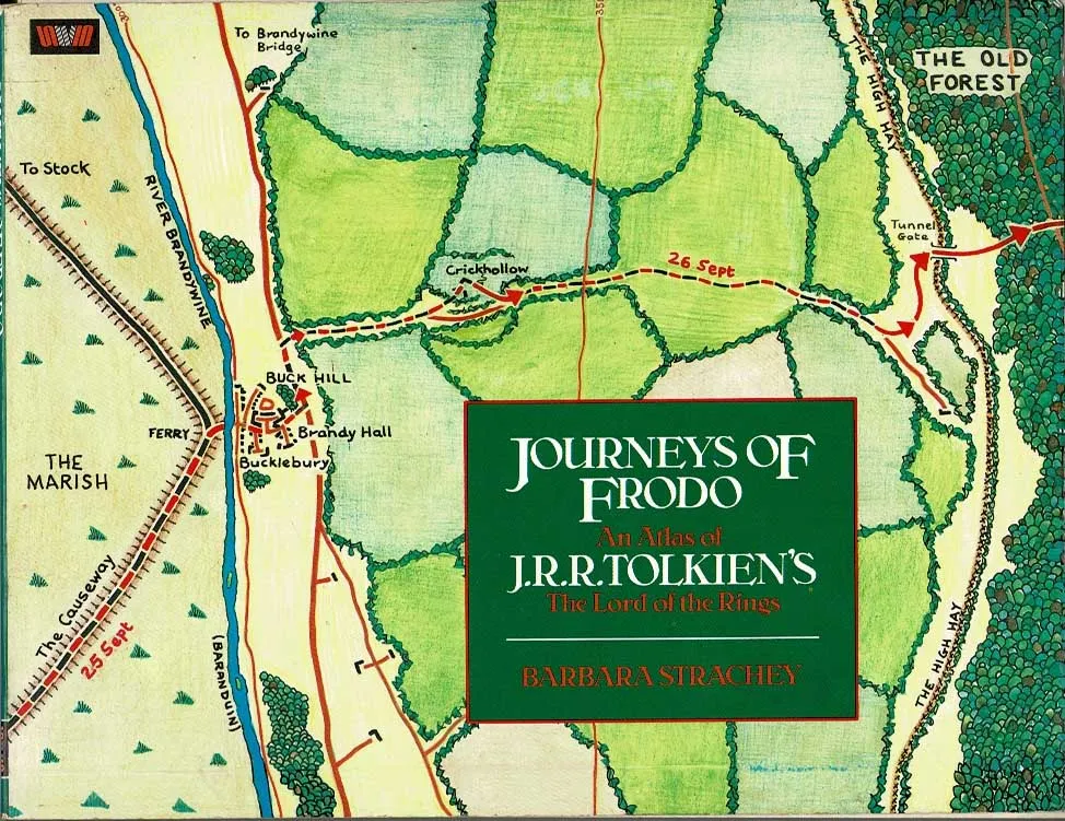
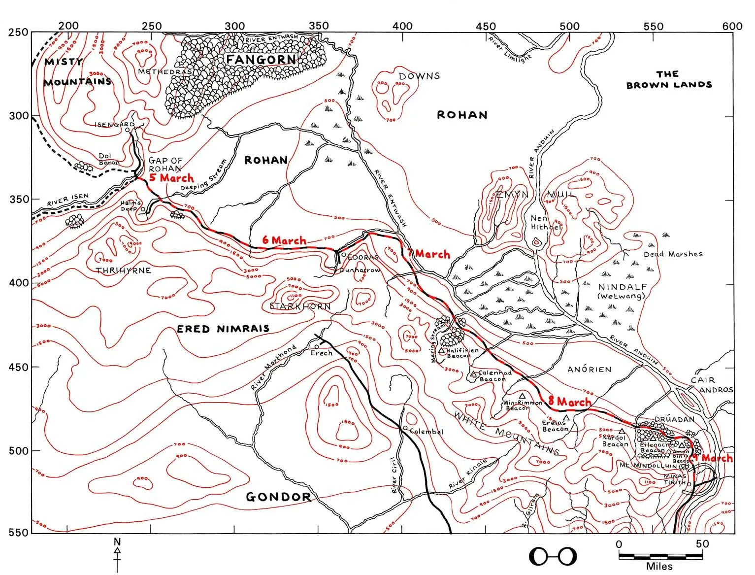
Barbara Strachey drew and published a book of 51 maps at various scales covering Frodo and Sam’s journeys from the Shire to the Crack of Doom, back to the Shire and eventually to the Grey Havens, as well as the other members of the Fellowship after they were split up. I cannot recommend her book enough, her maps have a wonderful fluidity from being hand-drawn, they are executed in the classic Tolkien ‘black-and-red’ style and by her careful reading of the text she shows how far they travelled each day.
I used Barbara Strachey’s work to confirm the location of most of the named places on the map and also bits of her contouring to understand the topography of the story.
The X-Y grid around the edges of Strachey's maps shows miles east of, and miles south of Hobbiton in the Shire. At the bottom of the page is a simple diagram showing the phase(s) of the Moon at the time the narrative traverses this area. The fact that she could do this shows how carefully JRR Tolkien must have mapped the story as it was written.
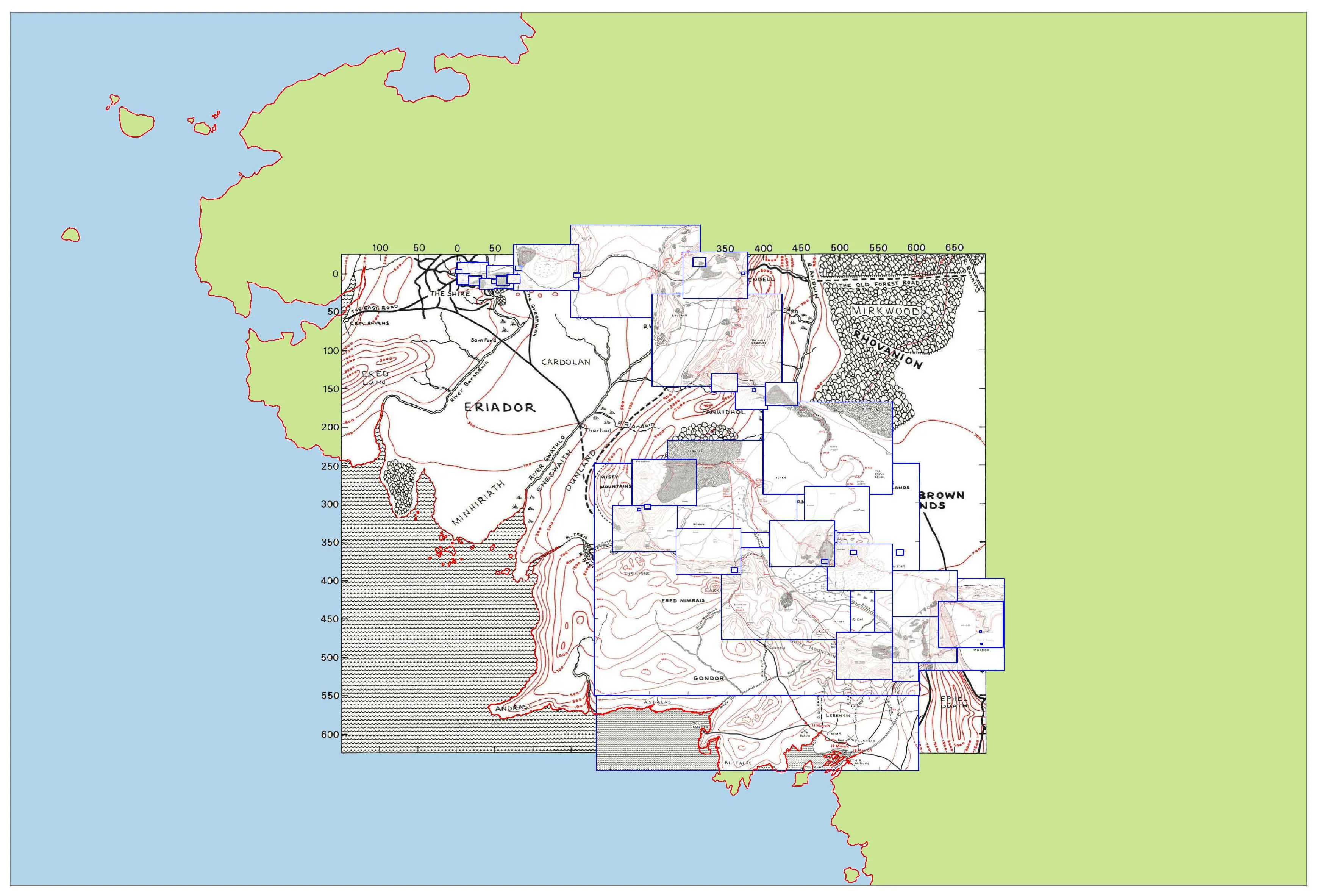
Each of Strachey’s maps is drawn at a scale to suit that stage of the story, so that you have to enlarge or reduce them and then overlay them to see them in relationship to each other, and because they closely follow the narrative itself the maps do not cover the whole of Middle-earth, they do not for instance show such exotica as The Sea of Rhun or The Iron Hills.
In putting this map on the internet I am trying to persuade HarperCollins Publishers (who vet copyright and trademark applications on behalf of the Tolkien Estate) to allow me to publish and sell my map in paper form. They are worried about John Ronald Reuel Tolkien's legacy being commercialised. If you think that my version of Middle-earth is worthy as a respectful 'homage', please drop them a message at enquiries@harpercollins.co.uk
.webp)