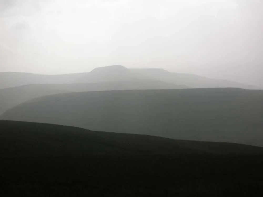
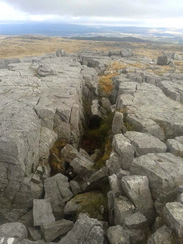
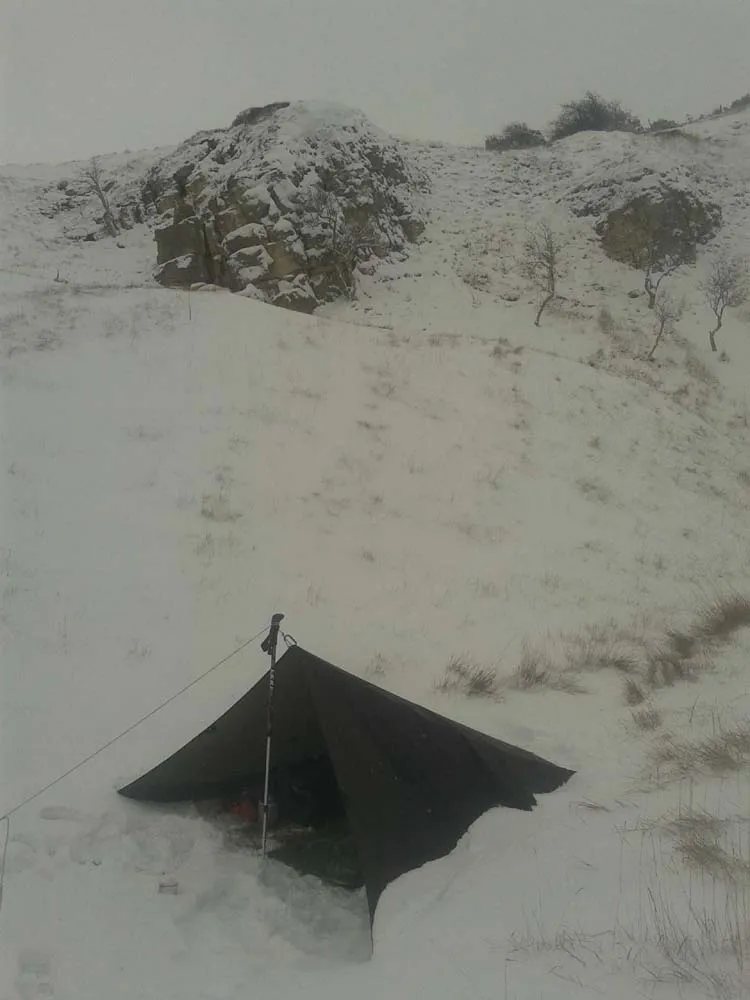
Having read The Lord of the Rings as a child, I always wanted to copy Sam and Frodo and travel on foot in wild lands. The furthest I have got is Wales, but still worth it, mostly the Brecon Beacons in South Wales from which the photographs on this site come. There are some places there where you cannot see a house, a road or even a fence, which is unusual in Britain. Though at night, the single light of a distant cottage miles away across the hills can be a friendly sight to a solo camper.


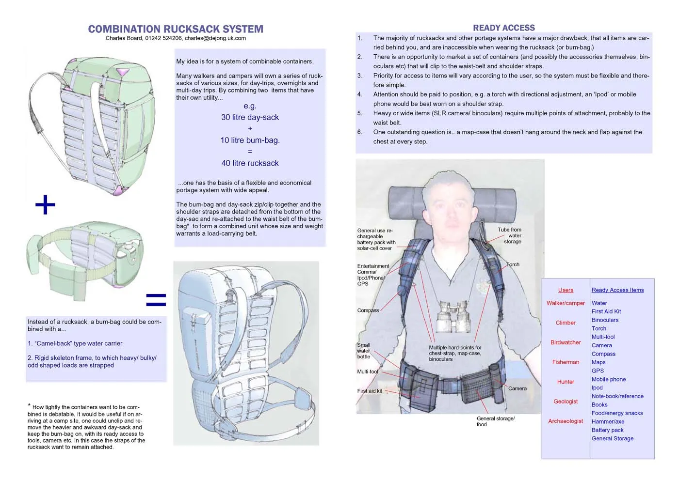
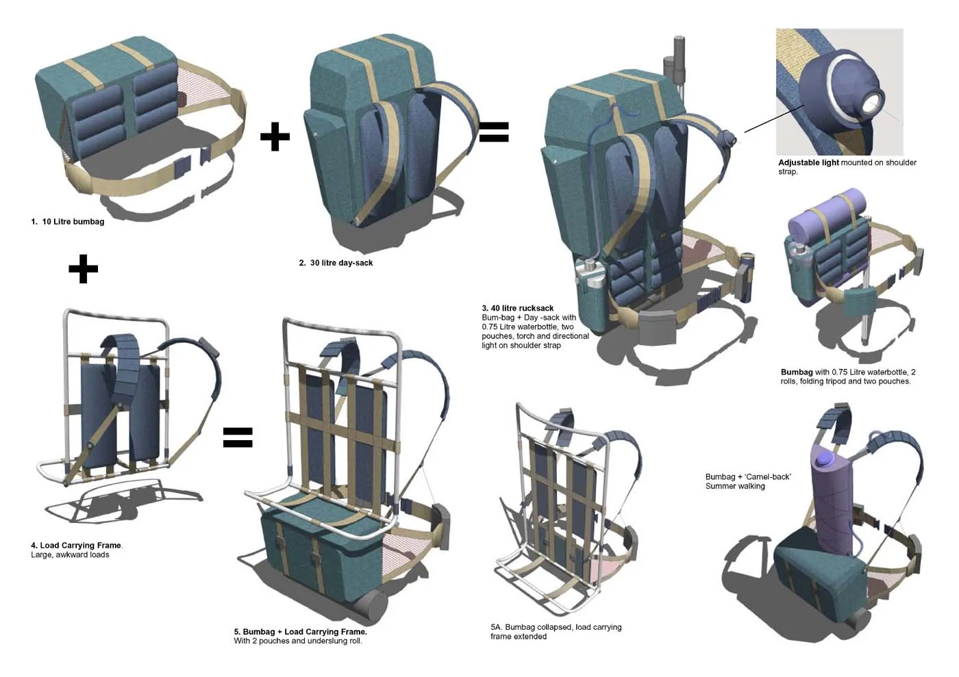
For my ideas on flexible, plug-together camping components, contact me

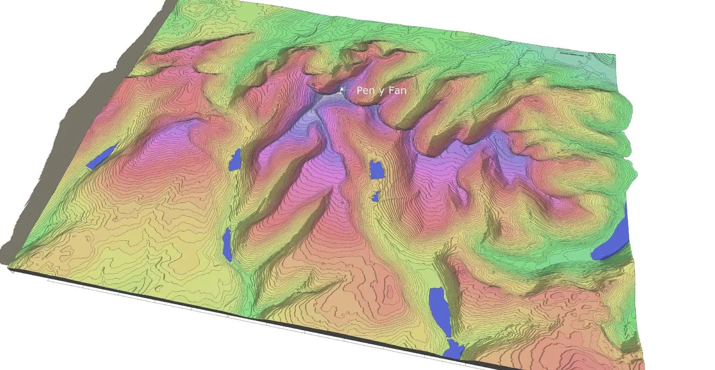
Various types of 3D data e.g. contours, can be downloaded for free from the Ordnance Survey Opendata site. These are available in .dwg, .dxf and other formats. When I downloaded the contour data for the Brecon beacons, I had to join up the contour lines where they were broken by height notation text but this is still a huge resource.
The images below are of 3D models I made showing the contours at 10 metre intervals for 192 square kilometres centred around Pen-y-Fan in the Brecon Beacons. These models are available to download in Sketchup8 format from 3D Warehouse, just search under “Brecon Beacons.” (Also available is my cool new model of the Cold-War Alvis 'Stalwart' High Mobility Load Carrier.)
https://3dwarehouse.sketchup.com/search/models?q=Brecon+beacons


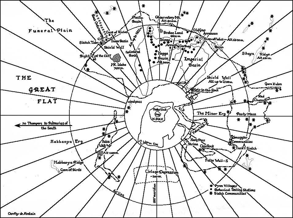
If The Lord of the Rings is my favourite “High Fantasy” novel, then Dune is my favourite science-fiction story. So, of course, I made a 3D model of the northern hemisphere of Planet Arrakis, “Dune”. This was copied from the map by Dorothy De Fontaine that is included in the paperback edition of the book. The model is pretty simple but those who know Sketchup will appreciate that extruding from flat surfaces on a spherical model opens up a multitude of “cracks” which have to be repaired.
Download at
And finally, if anyone cares to see my drawings and analysis of the city of Ankh-Morpork, from Sir Terry Pratchett’s 'Discworld' books, these are available on my work website.
.webp)